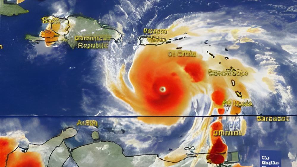
Tonight, Hurricane Dean is a dangerous category 3 hurricane with winds of 125 mph. At 3:00 this afternoon, dean was 840 miles east southeast of Kingston Jamaica, moving west at about 21 mph. Moving west means headed in Belize's direction. So will it make landfall here? And if it is what do you need to do? Well we went to the Met Office for some tips from forecaster Frank Tench.
Frank Tench, Meteorologist
"Well we should be concerned as of now because of the fact that this storm is headed into our general region."
As of 9:00 am, this is the track that the experts expect Hurricane Dean to take. This computer projection shows the outer bands and how those would affect northern Belize, even if the eye of the storm went off the tip of the Yucatan Peninsula: This illustration shows the projection cone and Belize is squarely within that. This model shows 11 major projections and only one of them takes the storm right through Belize. 8 of them say Dean is going north. So with all this data, what is it going to be?
Frank Tench,
"The consensus of all the model products would suggest that the storm is likely to make landfall somewhere along the Yucatan coast between Monday evening and Tuesday morning."
Jules Vasquez Reporting,
What's your gut feeling?
Frank Tench,
"I believe this storm will have its greatest impact on the northern districts of Corozal, Orange Walk, and the cayes. Tropical storm force winds, at most, and an increase in rainfall over those districts and even the coastal parts of the country, as far south as Belize or Dangriga, showers and thunderstorms likely."
So what should you be doing?
Frank Tench,
"Since the northern part of the country appears to be at most risk, people on the cayes of San Pedro, Caye Caulker etc. should take effect preparations for the worst case scenario as early as this weekend. I say that because Monday we expect this storm to be in the western Caribbean and its going to move closer to the Yucatan Peninsula between Monday and Tuesday and to wait until Monday to effect those plans, I think would be too late.
So for the people on the cayes, some type of preparations to either move off the island or if you feel that you can survive the storm from the island, then do whatever preparation you need to do to survive the storm. The same applies for people on the mainland and over the northern districts of Corozal and Orange Walk. Get your plans together for the worst case scenario. As early as this weekend, for the same reason that if you wait until Monday, it would be too close to get your plans completed effectively."
And at this point, forecasters cannot say how strong Dean will be if and when it reaches there - but it is expected to be a major hurricane.
This afternoon, NEMO held its first meeting to evaluate the hurricane threat. NEMO's next meeting will be held on Sunday Norning at 9:00. NEMO's first notice advises the public to monitor local radio and TV stations for advisories from the Met Service and to put family emergency response plans into action.