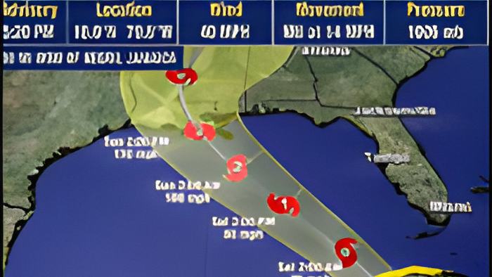
There is another tropical weather system out in the Southwestern Caribbean Sea, and Belizean authorities are advising the general public to keep an eye on it. That system was a nameless Tropical Wave that was formed several days ago, and tonight, it is making its way west as Tropical Storm Ida.
Yesterday, in a press release from the Cabinet, GOB said the system will move closer to our area over the next two days as a weak tropical depression…and is expected to bring rains and flooding, especially in the northern part of the country over the weekend.
Since then, it has organized and strengthened to a tropical storm, but weather forecasts say that it will not affect Belize. It is believed that the system will pass into the Gulf of Mexico, where it could intensify into a hurricane that hits the southern coast of the United States.
This evening, we spoke via Zoom with Chief Meteorologist Ronald Gordon about the system and how it is likely to behave over the next few days:

Ronald Gordon - Chief Meteorologist, NMS
"We have been monitoring the tropical wave as it progressed across the Caribbean Sea. Yesterday, it had not developed a center as yet, and there was wide uncertainty about where the system would go. And therefore, it was prudent at that time to advise the general public to be on the alert for the possibility of it coming our way. Because the system had not developed, the uncertainty was high, and it was possible for it goes either from Northern Belize to Western Cuba. So, there was widespread in terms of where the system could have gone. As of this morning, the system became better organized, and it now has a center of circulation, so, the models are able to track it better, and predict where it's going. And since then, the models have consolidated, basically to come to a consensus. There is general agreement that the system will move northwestward toward the western tip of Cuba. Just for completeness, I should mention that the system is now a Tropical Storm Ida. It was upgraded just a few minutes ago, at about 3:20 local time. And as we speak, Ida is centered near latitude 18.0 degrees north, 79.8 degrees west, and moving to the northwest at 14 miles per hour, with maximum sustained winds of 40 miles per hour. So, it's just 5 miles per hour above what it was before, which changes it from a tropical depression to a tropical storm. With the current trajectory and the current forecast path, we expect minimal impact, if any from Ida. The system is passing well to the east and north of us, and will make landfall, as I mentioned before — it will go across the Cayman, Western Cuba, then move into the Gulf of Mexico, where it is forecasted to intensify further and possibly become a hurricane before it approaches the United States."
Forecast models say that it should be well out of Belize's area of concern sometime during the weekend. The public is advised to still keep an eye on this tropical storm's path.