We haven't gotten the breakdown of how many of today's 220 passengers were tourists - but yesterday inly about 20% of them were visitors.
For those few tourists who did come, they arrived right in the middle of some heavy weather.
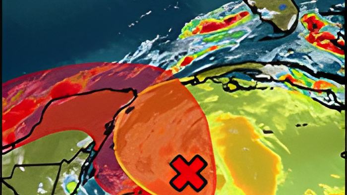
A weather system that was called TD 25 up until an hour ago is now Tropical Storm Gamma - with maximum winds of 40 miles per hour.
It is not projected to pose any direct threat to Belize and is projected to make landfall over the Northern Yucatan Peninsula tomorrow evening.
Still, that's our neighbour and the National Meteorological Service is alerting Belizeans to the possibility of heavy rainfall, gusty winds, and flooding when the storm intensifies and gets closer to northern Belize.
This afternoon before ti was upgraded to a Tropical Storm, we spoke via telephone with the Active Chief Meteorologist, Ronald Gordon, and here's what he had to say about the storm:
Ronald Gordon - Acting Chief Meteorologist, National Met Services

"The disturbance that we were monitoring over the past several days was declared or upgraded to Tropical Depression #25 at 9 this morning. At that time, the depression was centered near latitude 18.1 degrees north, longitude 84.7 west, and it was moving to the northwest at 9 miles per hour, with maximum sustained winds of 35 miles per hour. The forecast is for the depression to continue moving toward the northwest, and to eventually make landfall on the Northern Yucatan Peninsula of Mexico on Saturday as a tropical storm. So, the system is expected to intensify somewhat and become a tropical storm. This forecast track, the system will track north of Belize and will not make direct landfall over Belize. However, we do expect to have some impacts, moderate to minimal impacts from the outer feeder bands of the system. So we're expecting, in those bands, to get rainfall totaling over the next 2 to 3 days of about 4 to 6 inches. That could lead to localized flooding and slides over mountainous terrains, and low-lying areas and flood-prone areas will see some flooding. In addition to this, in those bands with thunderstorms and heavy rainfall, you could have gusty winds at times, and this could affect mariners operating small crafts. So, we do have a caution out for that as well."
"The outer bands extend several hundred kilometers from the system. This morning, we saw an outer band just off-shore Belize, actually, producing thunderstorms and showers."
"I believe that everybody should treat any weather system with a high level of urgency. However, we're not under a tropical storm watch, or a warning because we don't expect the system to make direct landfall on Belize. However, I do advise residents, especially those living in low-lying and flood-prone areas to be on the alert for the possibility of flooding from the feeder bands, as I mentioned. And of course, I do caution mariners not to venture out in the sea, especially later tonight, into tomorrow, as this system nears the Yucatan Peninsula and those bands come closer to the country."
Today's 4 p.m. advisory from the National Hurricane Center says, quote, "The system is expected to produce heavy rainfall that could result in life-threatening flooding over portions of the Yucatan Peninsula, far western Cuba, and well away from the center in the Mexican states of Campeche, Tabasco, and Northern Chiapas" End quote.
The 6:00 pm advisory upgraded it to a weak tropical storm.