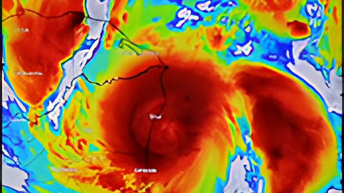
Tonight, Hurricane ETA is making a turbulent landfall over the coast of Nicaragua.
The slow-moving and extremely dangerous storm is battering the region's impoverished coastal populations. They've had to abandon their homes for the safety of shelters, and they're not out of the woods yet because while they've suffered through more than a dozen hours in the storm they'll have to continue to ride it out throughout the night.
It's the kind of storm that could have devastated our country, and while it's being visited upon our regional neighbors it's still headed our way.
Here's that story.
A slow moving Hurricane ETA barrelled unto Nicaragua's coast this afternoon as a category 4 storm. And while it's hitting in a far-flung region of the Miskito Coast it remains a threat to Belize.
We got an update on the storm's position from Chief MET officer Ronald Gordon a few hours ago.

Ronald Gordon, Chief MET Officer
"The latest update from the National Meteorological Center as of 3p.m. local time, hurricane ETA was centerade near latitude 13.8 degrees north, longitude 83.5 degrees west and that puts it about 15 miles south southwest of Puerto Cabezas, Nicaragua. In terms of distance from Belize that's about 400 miles southeast of Belize City."
Cherisse Halsall:
"What're some of the conditions that the people have been battling down there?"
Ronald Gordon, Chief MET Officer
"I would expect it to be catastrophic. A category 4 hurricane is nothing to play with, they would be experiencing significant storm surge, gusts of very strong winds, destructive winds in that area and torrential rainfall as well, especially those on the coast - the combination of rainfall along with storm surge, that's the water from the ocean coming in with the wind would be disastrous for those people living in that area just north of the center where the system is making landfall at the moment."
Cherisse Halsall:
"We know that this morning when the storm made landfall it was moving extremely slow, explain to me why that makes it worse?"
Ronald Gordon, Chief MET Officer
"A slow moving system is much worse for several reasons the main reason of course is rainfall accumulation. If you have a system sitting over you for several hours and then you have torrential rainfall falling, you could have a huge volume of rainfall accumulating in a very short time. Additionally the destructive force of the wind you have that wind power on you for such a long time it will destroy anything. Some structures that might survive if you have strong winds over a short time will not survive when you have continuous wind pushing on it, having that energy accumulating and that destructive force upon you."
And while Nicaraguans batten their hatches, Belize's shouldn't rest too easy as we remain in the path of what will hopefully be a weakened system.
Ronald Gordon, Chief MET Officer
"As the systems moves over Nicaragua and over land we expect it to weaken significantly, it is going to continue moving west to west northwestward across the mountainous terrain of Nicaragua and Honduras and it will eventually weaken to a tropical depression and even weaken to remnant low. After that in the long term there's a lot of uncertainty but the forecast is suggesting that the depression or remnants of ETA will eventually curve to the north and move across Guatemala and into southern Belize and then move off the coast of Belize northeastward into the northwest Caribbean Sea."
Gordon says the weekend forecast includes Rainfall, gusty winds, and widespread flash floods.
Ronald Gordon, Chief MET Officer
"Flooding of course as I mentioned is the major concern that we expect with this system. We have a flood warning actually for the entire central and southern Belize - Belize, Cayo, Stann Creek and Toledo District at the moment."
At 6:00 pm, because of its contact with land, Eta has weakened significantly. Maximum sustained winds have decreased to near 110 mph with higher gusts. Eta is now a strong category 2 hurricane. The National Hurricane Center Rapid weakening will continue as the center moves farther inland tonight and Wednesday.
Here in Belize, we're already starting to get rainfall. It's expected to continue through tomorrow afternoon and parts of Friday before we can expect a decrease.
We're also expecting gusty winds at 25 to 35 knots. Mariners, especially those piloting small craft are warned to seek safe harbor and to remain there.