This morning, the Ministry of Sustainable Development, Climate Change and Disaster Risk Management, and the National Meteorological Services hosted their 9th National Climate Outlook Forum.
This conference allows the climatologists, forecasters, and disaster management personnel to dive into the very dense topics of current weather trends and climate change patterns in the Caribbean, in order to forecast how the annual, Trans-Atlantic Hurricane season will affect the storm-battered nations of this region.
According to the experts, there are favourable conditions in the marine and atmospheric environments for the year 2021 to become yet another active hurricane season.
One of the speakers for today's forum was Chief Meteorologist Ronald Gordon. He provided a detailed outlook on the very favourable conditions for another active hurricane season:
Ronald Gordon - Chief Meteorologist
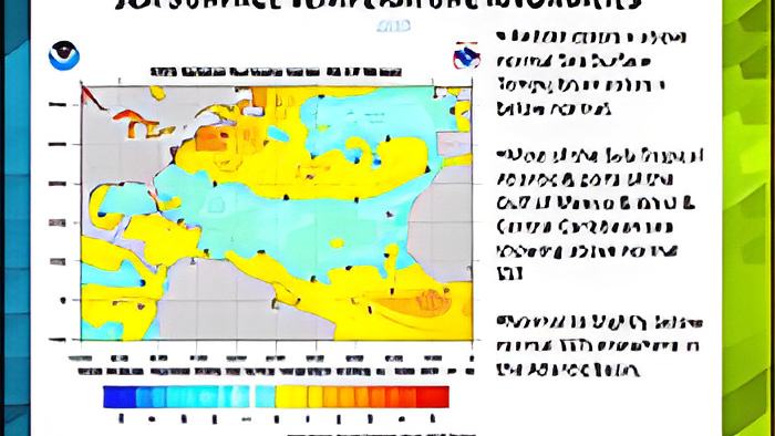
"Hurricanes, tropical systems are fuelled by the heat content in the oceans. So, the warmer your oceans are, the more energy there is for tropical cyclones to develop and intensify. And therefore, one of the first things we look at when we think about hurricane season activity, is how warm our sea surface temperatures are. And the map that you're seeing in front of you is the weekly average of sea surface temperatures. You can see that parts of the Gulf of Mexico, most of the Northwest Caribbean Sea, the Central Caribbean Sea, and especially the subtropical Atlantic Ocean, which is about 30 north are experiencing warmer than normal sea surface temperatures at the moment. On the contrary, the Sub-Tropical Atlantic Ocean and parts of the Caribbean are experiencing below normal temperatures, and those are shaded in the green toward the blue shade. However, we do not anticipate the Sub-Tropical Atlantic will remain that way. It is predicted that the temperatures will increase, before the peak of the season, which is around September 15th. The next major factor that drives hurricane or tropical cyclone development in our area is the El Nino Southern Oscillation. Whenever there's an El Nino, for example, warmer sea-surface temperatures in the Eastern Pacific area, or the Tropical Pacific Area, then more storms develop in that area, then more storms develop in that side of the basin, or in that area of the world, and those storms, whenever they intensify, they create strong upper-level winds. That would cross into our area from west to east, and they basically tear apart tropical systems trying to develop in the Atlantic basin, or the Caribbean. We refer to that as vertical wind shear. So, whenever there's an El Nino, tropical cyclone activity in our area tends to be suppressed. The chances of El Nino are much reduced, or there's less chance that there will be an El Nino. So, that suppressing factor is likely not to be there."
In that same presentation, the Chief Meteorologist took a closer look at all the regional forecast predictions of tropical cyclone activity for the 2021 hurricane season:
Ronald Gordon
"Here I have about 5 different forecasting agencies, and what they're predicting for this season. And in the red, again, I'll remind you of what the average season is, and for reference, we look at what happened last year, which was a very super-active hurricane season, as many of us will recall. So, one of the agencies, Tropical Storm Risk is saying 17 named storms, 8 becoming hurricanes and 3 major hurricanes. Colorado State University, 17 named storms as well, 8 hurricanes, but 4 major hurricanes, and the National Oceanographic Atmospheric Administration in the US is giving us not a single number, but they go within a range. So, for named storms, they're forecasting a range of 13 to 20 named storms, 6 to 10 of those becoming hurricanes, and 3 to 5 becoming major hurricanes. Our partner institution or one of the regional institutions that we work very closely with, the Caribbean Institute for Meteorology and Hydrology also has started doing seasonal predictions. They only forecast within the named storms' category, and they are forecasting 14 to 22 named storms for this year. AccuWeather, they're going for 16 to 20 named storms, 7 to 10 hurricanes, and 3 to 5 major hurricanes. The picture that you're seeing clearly is that all agencies are forecasting slightly above-normal activity, compared to the 1991 to 2020 Average."
The National Emergency Management Organization also participated in today's forum, and according to the Coordinator, Shelton Defour, they plan to roll out a disaster risk mitigation campaign, just in time for the expected peak of the hurricane season:
Col. (Ret.d) Shelton Defour - Coordinator, NEMO
"We are near the peak period of the hurricane season, and so we must increase our emergency and disaster readiness. For us, at the national level, we are fine-tuning. We have gone through some of the necessary preparations, whether it setting up the national and district committees, which are very important in terms of the national structure. If you understand NEMO, the framework is at the top, NEMO is chaired by the Prime Minister. Below we have national operational committees chaired by CEOs and a few heads of department. Below that, we have district emergency committees chaired by area representatives or ministers of government, as appointed by the Prime Minister, and then below that, we have village emergency committees. So, we're fine-tuning that structure, making sure that the required state of readiness levels can be maintained or advanced. And we are advocating strongly that this must be the approach by line ministries in particular, in which these committees are embedded, so, that when we transition from a non-crisis time to a crisis time, then it should be smooth. The business sector, communities, and in particular families must be doing the same. So, one of the things that we're embarking on will be a house to house campaign, just as you have a political campaign, or a war campaign, we're going to do a disaster risk management campaign, house to house, community to community, engaging people to find out what's happening. We must plan for the worst."
According to the experts, a 30-year comparison of the Atlantic Hurricane seasons, from 1981 to 2020, revealed that there was an "average" of 12 named storms, 6 hurricanes, and 3 major hurricanes. For the 30-year study from 1991 to 2020, the average season has gone up slightly to 14 named storms, 7 hurricanes, and 3 of which turned into major hurricanes. According to the Chief Meteorologist, the data indicates that the increase is due to the fact that all nations along the Trans-Atlantic Hurricane belt are in a "more enhanced" period of tropical cyclone activity.