Last night, you heard the Garifuna Nation claim communal land rights on behalf of the Garifuna Belizeans living in Punta Gorda, Toledo, and Seine Bight Village in Stann Creek.
Like the Maya of the Toledo District, the Garifuna is another group of indigenous peoples that call Belize home. And so, they are of the view that principles established in the Maya Land Rights judgment, which confirmed that communal land rights exist and must be protected, also apply to them.
That view may later become the source of future land disputes, but 7News has learned that some of the Maya Villages have started to take steps to identify exactly where their village boundaries are. They are doing this so that whenever the compliance disputes arising from the judgment are resolved at the Caribbean Court of Justice, they will have a head start.
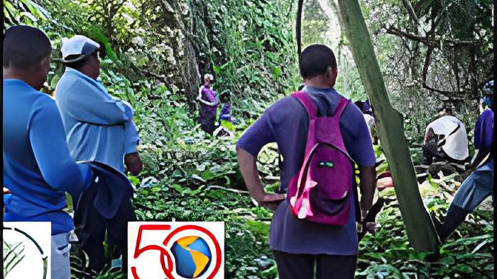
2 days ago, SATIIM, which has agitated on behalf of the Maya communities, reported that they have helped the Maya residents of Conejo to identify their village's boundary. With funding provided by the Inter-American Foundation, SATIIM provided several of the Mayan communities with GPS training and education. Earlier this month, villagers of Conejo and Midway used this knowledge to jointly trek into the forests to demarcate where their community borders are. It is one in a series of such exercises to determine where these communities meet. Today, we got a chance to speak via Zoom teleconference with a representative of SATIIM about these first verification exercises.:
Martin Cus - Community Mobilizer, SATIIM
"To begin the mapping with Conejo, what happened was we trained several guys to use the GPS and using the compass. So, they were being trained, so that they could be able to go in the field to collect the GPS coordinates of their village boundary with their neighboring communities. During that, the community and leaders of Conejo had a meeting with the neighboring communities, especially, we have Santa Ana, Midway, we have Sunday Wood. Those are the 3 communities that border Conejo. Doing the ground shooting, collecting the data - the coordinates, most importantly, the leaders from Conejo invited the leaders from the neighboring communities to go along with them in the forest. And they would be able to invite elders of the community as well so that they can be able to identify where the boundary lines lie and verify so both of them can be able to agree. If there is a dispute between a village, an outsider comes in, and we'll be able to get the leaders, have meetings. So far, I haven't seen anything that caused a dispute between villages. For example, they knew the areas from before, and the reason why they invited elders of the community; some village leaders are younger people."