The red flag with a black centre is flying over Belize tonight, as the country is under a Hurricane Watch. The west-ward moving tropical wave that we told you about last night, quickly formed into a Tropical Storm this morning - and is forecasted to be a category one storm when it makes landfall on Belize on Thursday.
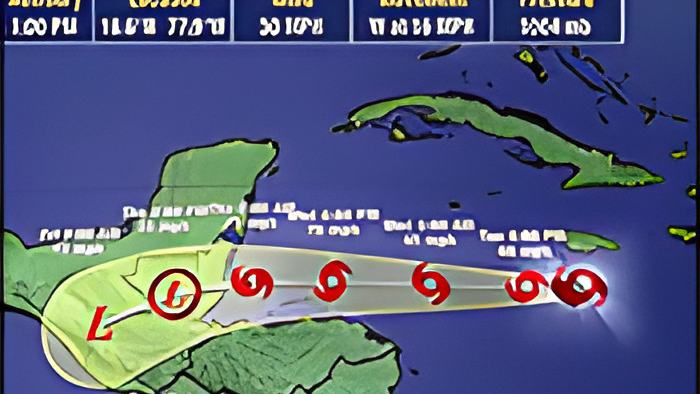
The latest advisory from the NEMO and the National Met Services says that at 4:30 p.m. this evening, TS Nana was located about 590 miles east of Belize City. It is moving along its westerly path at 18 miles per hour with maximum sustained winds of 50 miles per hour. It is expected to continue on its path to Belize's coast, and the experts are estimating that it will make landfall with maximum winds between 75 and 95 miles per hour.
Early forecast models were predicting that it would become a tropical depression, but the storm has become stronger more organized than anticipated. Here's what the Deputy Chief Meteorologist told us this evening in a virtual press briefing:
Ronald Gordon - Deputy Chief Meteorologist
"The system is located over relatively warm sea surface temperatures, between 29 and 30 degrees celsius. We also mentioned that the system is in an environment of very low, vertical wind shear. So, that is one factor that also favored the system, and also moisture. What was preventing the system from developing was the fast forward speed. That was one of the factors that were inhibiting development. So, it looks like 3 to 1, and the 3 won out. And the system became a tropical storm, as you mentioned this morning. The latest position has it at 16.8 degrees north, 78.3 degrees west, which is about 590 miles east of Belize City. The system is moving to the west, at about 18 miles per hour, with maximum sustained winds of 50 miles per hour. We are looking at this system moving westward or the next 24 to 48 hours. And there is the possibility of it intensifying to a category 1 hurricane, before making landfall somewhere on Belize, possibly Thursday morning."

"If you look at the current projection, and the cone of uncertainty - as we refer to it - it extends from Northern Belize, to just about the border with Guatemala in the south. So, basically, it has the entire country encompassing that cone. So, the highest chance of it affecting anywhere is on the coastline of Belize. There is always some minimal probability of it going outside that cone. But the highest probability is that it makes landfall on the coast-line of Belize. Now, where will that center come ashore, we cannot say at this moment. And that is why there is a tropical storm watch for the entire coast of Belize, from Northern Belize to Southern Belize. And I will mention now that it is very likely that later this evening, that will be upgraded to a tropical storm warning, and possible hurricane watches for the coastline of Belize."
"We will continue to see fair weather tonight, and most of tomorrow. We're expecting conditions to start deteriorating across the country late tomorrow evening, into tomorrow night, starting with bands of showers and thunderstorms coming across. After that, whenever the system approaches to land and is very near, and wherever that center makes landfall, that area will be looking out for category 1 hurricane winds ranging between 74 and 95 miles per hour. There is a possibility of a storm surge. I wouldn't give a specific value yet. We have to wait and see as it gets nearer, but there's definitely going to be storm surge north of that center, and rainfall of about 4 to 6 inches also, which could lead to coastal flooding, along with the storm surge. And those residents inland, living along streams and rivers will also see those river flooding from the rainfall."
"Hurricane Earl, which is the last hurricane to affect Belize, was 2016, and I think it's fresh in most of our minds. Structures that don't have strong roofing can see their roofs torn off. If you have trees and so that are close, they can be uprooted, and flung on your house and damage it as well. And of course, the storm surges, as I mentioned before, that we saw in Earl. So, those factors, that level of damage is what you can expect from a category 1 hurricane."
NEMO's 4:30 p.m. advisory also states, quote, "NEMO hereby declares a HURRICANE WATCH for Belize (one red flag with a black center), Belize City, and the Cayes are under a Tropical Strom WARNING. The Warning is declared as the system path puts those areas under direct threat....The next declaration is expected to be a Hurricane Warning (two red flags with a black center flown one above the other) which means it is imminent that the Hurricane will make landfall on Belize within 24 hours" End quote. You can see the entire advisory on our 7newsbelize facebook page.