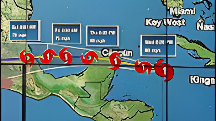
Tonight, Hurricane Grace is a category 1 storm, expected to make landfall between Playa Del Carmen and Tulum, Mexico in a few hours.
The storm has not deviated from the path which experts forecasted, and so, Belize is not at risk of experiencing hurricane conditions - and there are no warnings or watches in effect. But, meteorologists say that Belizeans, especially those living in the northern districts, should brace for quite a bit of rain, which is expected to last well into the weekend.
This afternoon, we spoke to Chief Meteorologist Ronald Gordon via Zoom to discuss the expected impacts of the storm on Belize:
Ronald Gordon - Chief Meteorologist

"As of Midday, the system is about 360 miles east by north of Corozal Town, and about 368 miles east northeast of Belize City. The Hurricane - it's already a hurricane - is heading to the west-northwest at 15 miles per hour with maximum sustained winds of 75 miles per hour. Additional strengthening is forecasted, and there is the possibility that Grace could be a minimal category 2 hurricane at the time of landfall. Landfall is forecast to occur on the Mexican side of the Yucatan Peninsula, somewhere near Playa Del Carmen, or between Tulum and Playa Del Carmen. That should occur tomorrow morning at about 6 or so more or less, or maybe a little bit before that time. In terms of the threat to us. We notice that the system is going further north, therefore, it will make landfall north of the country of Belize. The landfalling system in our area that occurs north of you means that you are on the better side of that system. The winds are not going to be as strong, and also, a hazard, for example like storm surge, is not going to affect persons on the southern side of a landfalling hurricane in our area. So, right away, we know that storm surge is not a threat to us. What can we expect then? The system is, like I said, a bit north of us. The radius of winds on the southern typically does not extend as far out. So, we are not looking at tropical storm-force winds over us. The latest that we have seen is for us to get about 15 to 25 nautal-mile winds and possibly higher gusts in showers and thunderstorms. Also, importantly, those winds are not forecasted to occur well after the system has moved further west over Yucatan when we develop a southeasterly airflow behind that system. The other hazard that we are on the lookout for is rainfall. We cannot avoid that. The latest projection is calling for 1 to 4 inches of rainfall associated with this system, and that is stretched out over a period from about tonight through to about Saturday, maybe even into Sunday. However, we cannot discount the potential for a feeder band to cross us and dumping heavier rainfall than that. So, that is a possibility, and that leads me to what alerts are we issuing. Well, number 1, let me repeat, we are not under a hurricane watch or a hurricane warning. We are not under a tropical storm watch or a tropical storm warning, precisely because the system is making landfall well to the north of us, and therefore, we do not expect to be in tropical storm or hurricane-force winds. So, let me discount that once and for all. The alerts that we have issued are for 2 things, the possibility of localized flooding and that is is associated with the rainfall that I mentioned, and also the potential for heavier rainfall in the feeder bands into the system. Another alert is for small craft warning, and that is likely to go into effect tonight."
The latest report from the National Hurricane Center indicates that Hurricane Grace has gained a little strength. Its maximum sustained winds are now at 80 miles per hour.