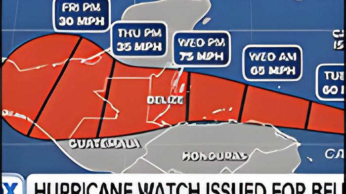
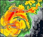

Tonight, Tropical Storm Lisa is chugging through the Eastern Caribbean Sea - and she has her sights set on Belize.
That's why all of Belize is under a RED - 1 Hurricane Watch tonight - meaning that Lisa is expected to make landfall somewhere along the coast of Belize within 36 to 48 hours.
At 6:00 pm, TS Lisa was centered about 630 miles east Southeast of Belize City, moving west at 14 miles an hour, with maximum winds of 45 miles per hour.
So, what should you do now? And what do you need to get ready for? Here's most of what you need to know about Lisa tonight - from a NEMO virtual press conference this morning:
Tropical Storm Lisa's projection path has it heading straight for Belize. And while storms aren't completely predictable, and at this point, the forecast indicates that it will be making landfall as a category 1 hurricane on Wednesday night.
And like with every storm threatening the country, the MET Service's surveillance system is fully engaged.
According to the Chief MET Officer, Ronald Gordon, if Lisa continues towards Belize, we'll be seeing the rains starting earlier on Wednesday, and continuing throughout the night.

Ronald Gordon, Chief MET Officer
"With that kind of forecast, the impacts that we're expecting is that this system could produce, first of all rainfall, in the amounts of 2-4 inches per day starting on Wednesday, through to Wednesday night and Thursday. In terms of flooding, that could result in flooding especially over low lying and flood prone areas and even so more considering the fact that we do have soils that are saturated from the recent torrents from Hurricane Julia."
"In addition to the rainfall and the flooding due to rainfall, there's likely to be coastal flooding due to storm surges up to about 3-5 feet possibly, especially to the north of the center actually, of where system makes landfall and that could result in, like I said, an increase in flooding for coastal residents. And in terms of a category 1 hurricane, those are systems of winds of 74-90 miles per hour so we're expecting those winds to affect those areas just around the center where the system makes landfall."
But Gordon warns that just because it's a relatively weaker, or compact storm, doesn't mean it's any less dangerous.
Ronald Gordon, Chief MET Officer
"The radius of the maximum winds are not going to be that extensive from the center, so you will have a narrow path in terms of where it makes landfall and the impacts."
"Important to note, compact systems sometimes are stronger, we always give the example of the skater, then they pull in their hands, they're able to rotate faster, so a system that is more compact will tend to have stronger winds where the center is."
Courtney Menzies:
"As you said, the hurricane, if it does hit Belize, it's likely going to be a category 1, but we know that in the past there have been hurricanes that intensify rapidly right before they reach, is this something that we're, maybe not expecting, but preparing for?"
"Even though we have made a lot of progress monitoring the path of these systems, when it comes to intensification, and especially rapid intensification, there's still some work to do there. We are guided by all the knowledge that we have, all the factors that we're looking at, and everything that we are seeing, is not indicating that the system will intensify beyond a category 1 and even though the wind sheer will weaken, it will still be a more moderate wind shear especially to the north, the environment like I said, is relatively dry and the storm is moving rapidly as well, it's not one of those systems that slow down and intensify so those factors in general will not favor rapid intensification."

And as of this afternoon, NEMO declared a hurricane watch, Red - 1, for the entire coast of Belize. The coordinator explained that they have already started preparing by ensuring that storage houses are stocked and the emergency teams are ready to save lives, if needed.
Ret'd. Col. Shelton Defour, Coordinator, NEMO
"We notified all our national committees and district committees for them to activate, convene an emergency meeting to go through their state of readiness, that was done except for Cayo which is going through that process or that meeting as we speak. The next area of operational readiness was that of our logistics where we checked the stocks in our storage houses to ensure that we had the basic supplies to start off the operation and to look at what needs to be procured and we're in the process of gathering some additional supplies. Our search and rescue component was alerted, BISART, Coast Guard, BDF, all those critical uniform services that will assist us in terms of getting ready for any potential rescue."
Orlando Habet, Minister of Disaster Risk Management
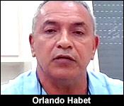
"For us, especially knowing that we can lose in terms of assets, and all these things are important, agriculture, housing, infrastructure, but primarily for us our greatest asset is our human natural resource, our people. So you will hear the MET office and NEMO making these advisories and certainly telling people that they have to listen to the advisories and certainly that they have to be keen and take heed on those advisories which are very important."
And Defour also explained that, aside from the rains and floods, the public can expect uprooted trees causing damage to infrastructure, and power lines being knocked down.
Ret'd. Col. Shelton Defour, Coordinator, NEMO
"Impact you have things like trees, the branches will break, trees will be uprooted, power systems will be damaged, you won't have electricity for some time, so that will affect water because water runs with electricity, sewage system will have issues, falling debris could hurt people and things like that. Storm surges. I won't speak to most of the characteristics, but storm surge wind are some of the critical, and rainfall, but those are the things we have to be concerned about, roof failure, if you live in a home that is not well constructed, then you know you need to evacuate to safety."
The next 24-36 hours will be critical as we get a clearer idea of where Tropical Storm Lisa is heading, and how much stronger she will get. As for now, the public is advised to start putting their emergency disaster plans into effect.