She's called Tropical Storm Nana, and tonight, that storm has Belize under a hurricane warning - meaning the "two red flag" with a black centre is being flown above public buildings from Belize City southward. Those flags went up at 9:00 am - and signify that in those areas you should expect hurricane type conditions within 24 hours. Well, right now, those conditions are only maybe eight to 10 hours away.
Forecast models are suggesting that the storm will pass over the country sometime between midnight tonight and 6 a.m. tomorrow morning.
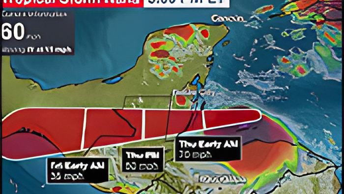
At 6:00 p.m this evening, the storm was located about ABOUT 100 miles east, southeast of Belize City, and it had maximum sustained winds of 60 miles per hour, moving west at 15mph.
According to the local and international weather experts, the storm, which was supposed to intensify a bit more today, changed very little in terms of its development.
For its 3 p.m. analysis of the storm, the National Hurricane Center in Miami said, quote, "Nana has not strengthened during the past several hours…" End quote.
But, the environmental conditions are still favorable for it to become a weak category 1 hurricane before it makes landfall later tonight.
This evening, we spoke via video conference with one of the meteorologists at the National Met Services, for a more detailed look at what changed between last night and this afternoon. Here's what she had to say:

Shanea Young - Meteorologist, National Met Services
"As of 3 p.m., as you said, Tropical Storm Nana has not intensified, and most of today, it has changed little in strength. Currently, it is still at 60 miles per hour, but there is still a possibility that it could become a minimal category 1 hurricane before it makes landfall. It has decreased slightly in speed. Right now, it's moving at 15 miles per hour, compared to earlier this morning, which was 18 miles per hour. And so, conditions are still favorable for it to still strengthen slightly before it makes landfall between midnight and early tomorrow morning."
"If you have been following satellite images, the conditions surrounding it are very moist. It was interacting with some low-level shear to the north earlier today. But, since it is approaching in-land, it is a small system, but it has regained some organization, even though it's not intensifying. So, it has maintained relatively stable, during the course of today. In front of us, we still have light wind shear, and also warm sea surface temperatures. It's closer, but it's still about 155 miles off-shore from the nearest point closest to Belize. So, with the projection for it to decrease in speeds, again tonight, there is still the possibility that it can strengthen somewhat before it reaches the coast, tonight."
"On the current projection, landfall could be anywhere between Belize City and Dangriga. But, you can't really focus on the center of the storm. It's not a big storm, but the distance between Belize City and Dangriga is relatively small. Anywhere within the hurricane warning area, from Belize City southward, it can make landfall. But, currently, it's looking more like anywhere between Dangriga and Independence."
"Currently, tropical-storm-force winds extend out to 70 miles from the center. So, anywhere between just north of Dangriga, could experience the wind speed that it is at right now, 60 miles or even higher, because you can get higher gusts within it. Belize City is also expected to experience tropical-storm-force winds if the system doesn't intensify further. But not that even though those 2 areas are the area of focus, as you asked about what could be expected in the north, they can also experience tropical-storm-force winds. That's why, currently, we have a tropical storm warning for those areas, north of Belize City, but in the event that it does strengthen and become a category 1 hurricane, then, anywhere between Belize City southward could experience category 1 wind-speeds, which is between 74 miles per hour, to above about 95 miles-per-hour winds."
"The storm has a lot of rainfall, and it has already produced a lot of rainfall over Caribbean countries, such as Jamaica its passage. Earlier this morning, the Yucatan Peninsula, even though it's quite a bit distant from them, have already started to experience some showers from outer bands of the system. Just recently, our satellite images and also our lightning detection system detected that in Belmopan and also in the Orange Walk area, they have started to experience thunderstorms activity. Right now, the rainfall is one of the biggest threats, and it's projected that some areas could receive between 3 to 6 inches, and like in the case between Belize City and Dangriga, where it might likely make landfall, they can expect isolated amounts of up to 8 inches of rainfall."
We note that the Hurricane Warning is in effect for the coast of Belize from Belize City southward, and a Tropical Storm Warning and a Hurricane Watch is in effect for the coastline north of Belize City.
At 3:00pm, the National Hurricane Center, in its discussion About TS Nana, said "Nana is running out of time to strengthen before landfall, and between that and the ongoing shear none of the intensity guidance forecasts it to become a hurricane before landfall....the intensity forecast calls for Nana to strengthen to near hurricane strength at landfall."