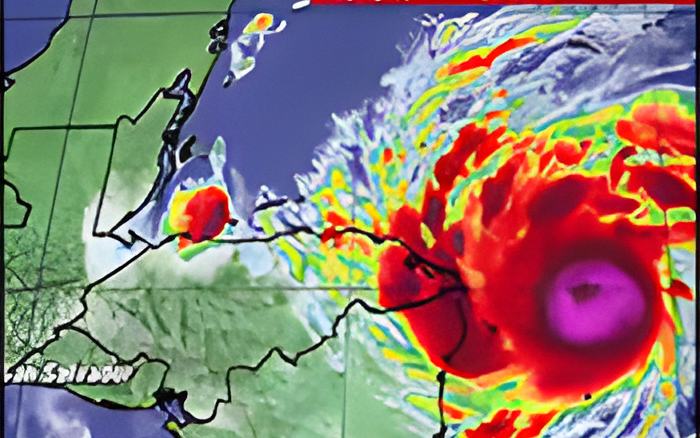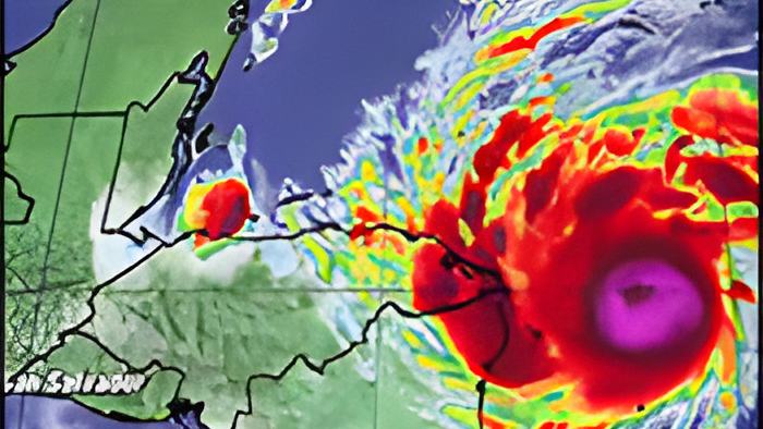
The current forecast has the storm going over the mountains of Nicaragua and Honduras before heading north towards Belize as a depression by Friday. But, there's a lot of uncertainty in the forecast for this storm and we discussed it with the acting Chief Met Officer this morning. He said Belize should expect very heavy rainfall:
Ronald Gordon, Chief MET Officer
"Looking at the impact for Belize, we are seeing the forecast showing us heavy rainfall at least starting through midweek and continuing through the end of the week. The possibility for it to be up to 10-20 inches of rainfall and higher amounts especially over southern and central Belize. That amount of rainfall could lead to severe flooding even though the storm is not going to make direct landfall on us. We are not expecting tropical storm nor hurricane force winds because there is an intense area of low pressure with that storm and a bridge of high pressure at northwest we have what we call are very tight pressure reading between those two systems to cause winds to strengthen. We are starting to see gusty winds developing offshore Belize and that is going to increase throughout the week. We are looking at the possibility between 15-35 knots on Wednesday to Thursday."
Reporter
"A lot of people see this track and it looks like it's going to PG. If it heads into southern Belize it will not do so as a hurricane or maybe not even a storm, it will probably be a tropical depression by that point."

Ronald Gordon, Chief MET Officer
"Of course there is at first the uncertainty going after 48 hours. If you notice, the cone widens significantly after that period of time and that is precisely because the models are at huge disagreement where the system will track across things to America or whether it will emerge into the gulf of Honduras. I caution residents ever to look at the center of the cone, like you said a depression to PG but that is just one possibility of many. It can emerge further east or even further south. The next important point is that of course it is moving with a very mountainous terrain and the system will most certainly be impacted by that type of terrain. We expect it to weaken rapidly, however that is not to minimize the threat. A tropical depression a weak pressure system can dump an intense amount of rainfall and cause severe outlook."
Reporter
"Explain to me how this north in Belize right now is somehow protecting us from this particular system and keeping/steering it more south."
Ronald Gordon, Chief MET Officer
"What we do have is a high pressure ridge building behind what was previously a cold front as anticipated already. What that does is that it tends to block systems from the northward. The ridge is entered through the gulf of Mexico. It is producing west to south west tally wind at the levels over us which is pushing the storm in that sort of direction for now. That bridge will eventually weaken and that is the reason why we are going to start seeing that it will eventually curve to the west and head to the northwest."
The very latest update says that at 6:00 pm, Maximum sustained winds have increased to near 150 mph with higher gusts - still a category 4 hurricane on the Saffir-Simpson Hurricane Wind Scale.
At 6:00, the eye of Hurricane Eta was about 70 miles east-southeast of Cabo Gracias A Dios on the Honduras / Nicaragua border and about 70 miles (110 km) east-northeast of Puerto Cabezas, Nicaragua.
The latest advisory from NEMO this afternoon says, quote "There is a lot of uncertainty regarding the motion of the system after 72 hours. There is a possibility that the remnants of Eta will track into the Gulf of Honduras on Friday where it could regain some strength. Tropical cyclone watches or warnings are not required for Belize since landfall will be well south of Belize over Nicaragua. The main threat to Belize is heavy rainfall, starting later today and tonight. Rainfall totals of 10-20 inches or higher is anticipated especially over southern Belize which is likely to cause flooding and landslides. Gusty winds are expected which are likely to produce large swells and damaging waves along the coast. A FLOOD WATCH is in effect for the Cayo, Belize, Stann Creek and Toledo districts. Southern Belize must brace for and be prepared to respond to severe flooding."
As the 28th named storm of the 2020, Eta ties the record for the number of named storms in a single season set back in 2005. We'll keep following it closely.