

Last night, we told you about the devastation that Hurricane Eta wreaked when it made landfall yesterday on Nicaragua's Caribbean Coast, just south of the City of Puerto Cabezas. It was packing winds of 140 miles per hour and international press reports say that the slow-moving hurricane devastated approximately 320 indigenous communities in its path to the Honduras/Nicaragua border, pulling off roofs, taking down trees and power lines, and causing massive flooding in Puerto Cabeza, one of Nicaragua's poorest regions.
And while she leaves a wake of catastrophic devastation, as of 6pm, Eta has weakened to a tropical depression with maximum sustained winds of 35 miles per hour.
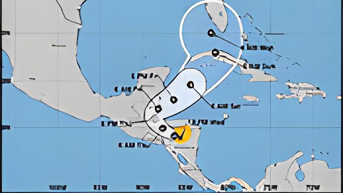
At this hour, the system is situated on the Honduras/Nicaragua border and moving west.
The forecast says what's left of Eta will brush past Belize by late Thursday and we start first with an evening interview with the Chief Met Officer, Ronald Gordon.
He spoke with us via zoom, and here's what he had to say about Eta's brief history as a dangerous Category 4 hurricane and the effects that it will have in Belize, going into the weekend:

Ronald Gordon - Acting Chief Meteorologist
"Hurricane Eta has made landfall over Nicaragua yesterday evening. And since then, it has continued to weaken, as we can expect, moving over land and over mountainous terrain, for that matter. And, the system is now down to a tropical storm, with a strength of 40 miles per hour. As of three this evening, it was located near latitude 13.9, North, 85.7 West, and that's about 100 miles east of Tegucigalpa, Honduras and from a local perspective, about 300 miles south southeast of Belize City. Eta is moving now to the west, or just north northwest that seven miles per hour. And, as I mentioned a weak tropical storm of 40 miles per hour. The system is expected to continue moving on that - on west or - sorry - it should turn to a West northwestward and eventually northward direction during the next few hours, and eventually emerge over the Gulf of Honduras later tonight into Friday. There is a possibility that the system might weaken even further. Well, of course, it will weaken we can tonight for depression, and then, we expect it may be to even weaken further to a remnant more, before emerging into the Gulf of Honduras. After that, it is forecast to move north then north-northeast, and it could re-intensify into a tropical storm sometime on Saturday while moving northeastward, away from Belize. In terms of the impacts on the country, we have already started experiencing the rainfall, from as early as Sunday, with the outer bands. And those rains have increased steadily over the past few days. The last we checked, we had up to 12 inches of rainfall already recorded over Baldy Beacon in the Mountain Pine Ridge, from one of our automatic weather stations located there. So, it seems as though the mountains are receiving the bulk of the rainfall at the moment. Other stations around the country are seeing three to five inches of rainfall already, from the system. We are forecasting up to 15 to 25 - even possibly up to 30 inches of rainfall coming from the system for the country. We're talking about total rainfall, from the inception of the system, until it moves away from us. Those rains are already producing flooding across the country. We had flood incidents in the West, as you may know, and we expect those floods to continue, with this amount of rainfall that we received, and the amount of saturation that the soils are receiving from the amount of rainfall. So, the major impact, the major threat from the system continues to be flooding, and we advise, of course, residents to take the necessary precautions, to safeguard your life from floodwaters."